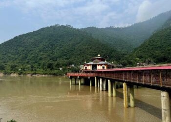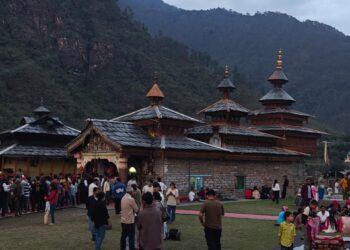

Uttarakhand is often called Devbhoomi, a land of rivers, forests, and sacred mountains. But behind this beauty lies a fragile environment that is highly vulnerable to natural disasters. Over the years, floods, landslides, cloudbursts, and glacier related events have become more frequent and intense. To understand why this is happening, we need to look at three major factors together: the natural geography of Uttarakhand, rapid development, and climate change.
Understanding the Natural Vulnerability
Uttarakhand lies in the Himalayan region, which is one of the youngest and most unstable mountain systems in the world. The land is steep, the rocks are not fully settled, and the area falls under high seismic zones. This makes the region naturally prone to earthquakes, landslides, and floods.
Heavy rainfall during the monsoon season further increases the risk. Rivers flow quickly through narrow valleys, so even a small increase in water can turn into a dangerous flood. Cloudbursts, which bring sudden and intense rainfall, are also common here.
Because of these natural conditions, disasters have always been part of life in Uttarakhand. However, the scale and frequency of these disasters have increased in recent decades.
Major Types of Disasters in Uttarakhand
The state faces multiple types of natural hazards:
Floods and flash floods are among the most common and destructive disasters. Events like the Kedarnath tragedy of 2013 and the Chamoli disaster of 2021 showed how quickly water can destroy entire regions. These disasters not only cause loss of life but also damage infrastructure and livelihoods.
Landslides occur frequently due to steep slopes and loose soil. In recent years, their number has increased sharply, especially along roads and construction areas.
Cloudbursts bring extreme rainfall in a short time, leading to sudden flooding and debris flows. Between 2015 and 2024, thousands of such events were recorded in the state.
Glacier related disasters, such as glacier lake outburst floods and ice avalanches, are also rising. These are particularly dangerous because they happen without much warning.
Role of Development in Increasing Risk
Development is important for economic growth, but in Uttarakhand it has often ignored environmental limits. After becoming a separate state in 2000, construction activities increased rapidly. Roads, dams, hotels, and towns expanded into sensitive mountain areas.
Unplanned construction weakens the natural structure of the mountains. Cutting hills for roads, blasting rocks, and dumping construction waste reduce slope stability. This makes landslides more likely, especially during heavy rainfall.
Hydropower projects, though useful for energy, also affect river systems. They change natural water flow and increase the risk of flooding in case of sudden water release or structural failure.
Tourism is another major factor. Millions of people visit Uttarakhand every year. While tourism supports the economy, excessive pressure on land, water, and infrastructure increases vulnerability. The 2013 disaster is often seen not just as a natural event but also as a result of unregulated tourism and construction.
Impact of Climate Change
Climate change is making an already fragile region even more unstable. Rising temperatures are causing glaciers to melt faster. This leads to the formation of unstable glacial lakes, which can burst suddenly and cause floods.
Rainfall patterns are also changing. Studies show an increase in extreme rainfall events in Uttarakhand, especially during the monsoon season.
In addition, weather systems like western disturbances are behaving differently due to climate change, bringing unexpected rain and snowfall.
Recent events across the Himalayan region also show a worrying trend. Scientists link increasing floods and landslides to warming temperatures and glacier instability.
All these changes mean that disasters are no longer rare events. They are becoming more frequent, unpredictable, and severe.
Development vs Environment: The Real Challenge
The biggest challenge for Uttarakhand is finding a balance between development and environmental protection. Development cannot stop, but it must be planned carefully.
Ignoring the carrying capacity of the mountains leads to disasters. When forests are cut, soil becomes loose. When rivers are blocked or diverted, natural flow is disturbed. When construction is done without proper planning, the risk increases for everyone.
Experts suggest that land use planning in the Himalayas should be based on geography, not just economic needs. Sustainable practices can reduce risk even if disasters cannot be completely avoided.
The Way Forward
To reduce disaster risk in Uttarakhand, several steps are important:
Better planning and regulation of construction activities in sensitive areas
Use of scientific methods for road building and slope stabilization
Protection of forests and natural ecosystems
Improved disaster warning systems and preparedness
Climate resilient infrastructure that can withstand extreme events
Local communities also play a key role. Traditional knowledge and sustainable practices can help in managing natural resources better.
Conclusion
Uttarakhand is a land of immense beauty, but also of great vulnerability. Natural disasters here are not just caused by nature alone. They are the result of a complex interaction between fragile geography, human activities, and changing climate.
If development continues without understanding these limits, disasters will only increase. But with careful planning, respect for nature, and awareness of climate change, it is possible to reduce risks and protect both people and the environment.
The future of Uttarakhand depends on how well we learn to live in harmony with the mountains, rather than trying to control them.